Transforming the Skies,One Drone at a Time
Nigeria's government-backed UAV company advancing aerial intelligence, certified pilot training, and scalable drone solutions across Africa.
Africa's Premier Government-Backed
Drone Technology Company
NASCAV Technology is a joint venture between NASENI and Caverton Group, two of Nigeria's most respected institutions in technology and aviation.
Learn Our Story
Innovative
Cutting-edge UAV systems built for Africa's terrain
Reliable
Government-grade precision with zero-compromise safety
Data-Driven
Every flight delivers actionable intelligence
Scalable
From single farms to national-level deployments
End-to-End Drone Solutions
Built for Africa.
UAV Pilot Training
Professional drone pilot certification programs accredited by NCAA. From beginner to advanced commercial operations.
- NCAA-certified programs
- Simulator + field training
- Commercial licensing
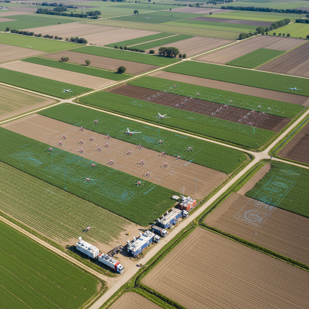
Precision Agriculture
AI-powered crop monitoring, spray operations, and yield optimization for large-scale farmers.
- NDVI crop analysis
- Precision spraying
- Yield forecasting
Drone Cleaning Solutions
Industrial cleaning for solar panels, high-rise buildings, and infrastructure using specialized UAV systems.
- Solar panel cleaning
- High-rise facades
- Industrial tanks
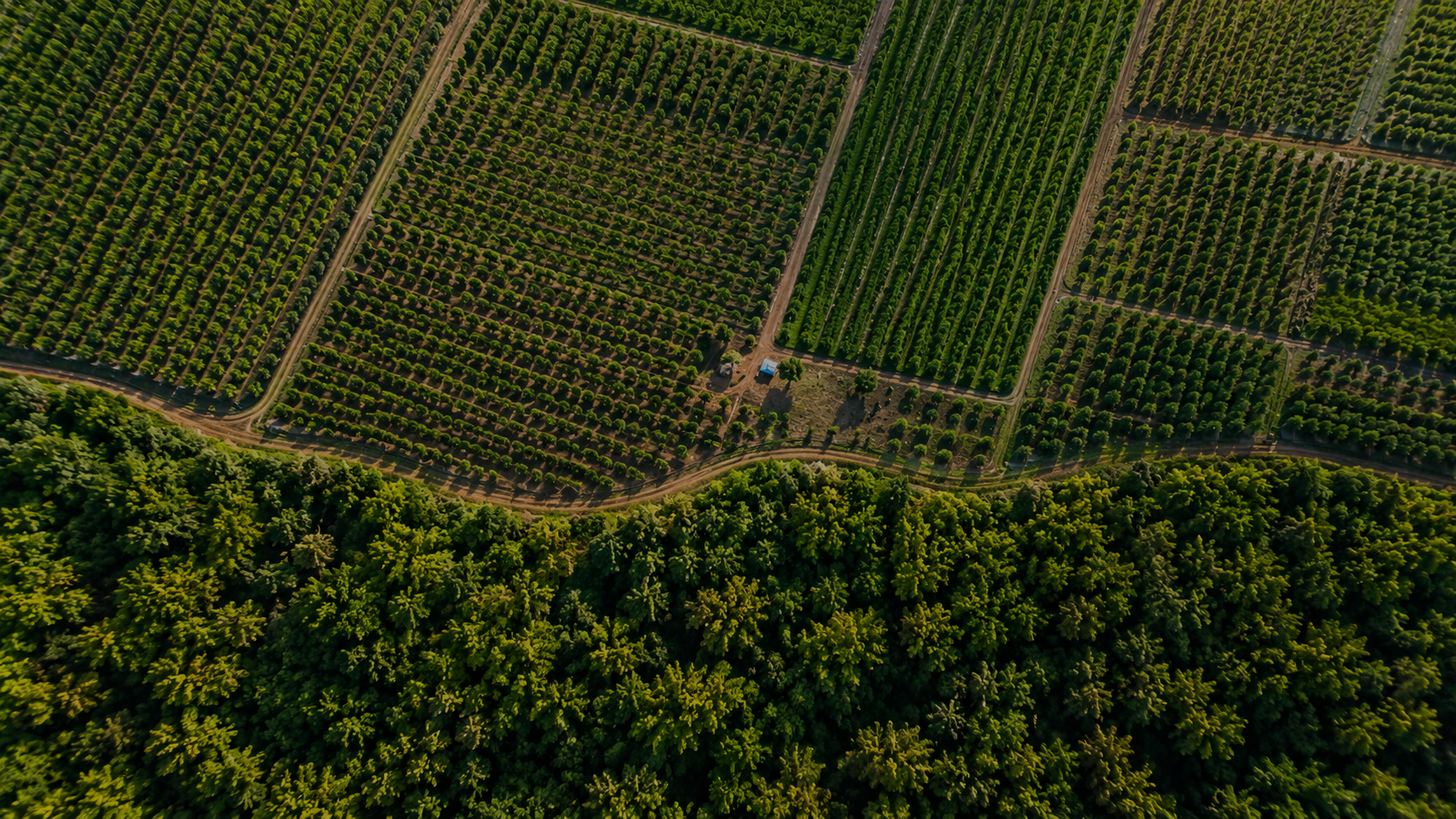
Farm Survey & Crop Monitoring
High-resolution aerial surveys delivering actionable agronomic data to maximize farm productivity.
- Multispectral imaging
- Soil health analysis
- Pest detection
Land Survey & Mapping
Centimeter-accurate topographic mapping for infrastructure planning, construction, and real estate.
- 3D terrain models
- Orthomosaic mapping
- GIS integration
The Infrastructure Behind
Africa's Drone Economy
When governments, agribusinesses, and security agencies need reliable aerial intelligence, they choose NASCAV. Our joint venture structure, technical depth, and operational track record make us the only drone company built for Nigeria's scale.
Government Backing
Established through NASENI, Nigeria's apex science and engineering agency, ensuring institutional credibility and regulatory alignment.
Aviation Certified
Full NCAA (Nigerian Civil Aviation Authority) compliance with internationally recognized safety protocols and operational standards.
Advanced Technology
Proprietary UAV systems with AI-powered analytics, real-time data processing, and multi-spectral imaging capabilities.
Expert Team
Over 50 certified drone engineers, pilots, and agronomists with combined decades of field experience across Africa.
Deployed Across Critical Sectors
Government Agencies
Federal & state surveillance, border monitoring
Agriculture
Large-scale farms, cooperatives, agribusiness
Security & Defense
Law enforcement, critical infrastructure
Infrastructure
Pipeline, power lines, construction
Education & Training
Universities, polytechnics, drone schools
Environmental
Forest monitoring, flood assessment, conservation
TRAIN. DEPLOY. SCALE.
NASCAV's three-pillar approach to building Africa's drone ecosystem from the ground up.
Train
Our NCAA-accredited training programs take students from zero to certified drone pilots in 4 to 12 weeks. Theory, simulation, and real-world flight training.
- NCAA certification
- 4 to 12 week programs
- Certified Training Facility
- Graduates deployed nationwide
Deploy
Certified pilots operate advanced UAV systems across agricultural fields, security perimeters, and infrastructure corridors, delivering data that drives decisions.
- Active missions nationwide
- Real-time data feeds
- Multi-sensor payloads
- Proven success rate
Scale
From a single farm to a national surveillance grid, NASCAV's infrastructure scales with your needs. Enterprise contracts, government frameworks, and SLA guarantees.
- Available in all states in Nigeria
- Enterprise contracts
- Government frameworks
- Extensive hectares surveyed
Take Africa's Agriculture & Security
to New Heights
Whether you're a government agency, large-scale farmer, or security organization, NASCAV has the drone technology, expertise, and infrastructure to deliver at scale.
Backed By